Backcountry navigation used to mean a map, compass, and a reasonable amount of trust in whoever marked the trail last along with “always being [over] prepared” — the classic Boy Scout moto. Now navigation largely means a phone with a GPS app (I use Gaia GPS, although I really dislike Outside, Inc.), and some custom tile overlays, and maybe some waypoints containing some beta (or information) about the area.
The fundamentals of navigation have shifted considerably, although you still need to have a sense of where you are. In general, backcountry trips have become much more forgiving because of communication and navigation technology!
Thinking back to how I was able to drive a car anywhere in an era before Google Maps on my phone (you printed out directions and definiteky got lost from time to time), I now find it similarly hard to remember the days where I did back country hiking with printed out topo maps, waypoint lists, and a compass.
This page covers my current and actual approach to navigation. From hanging out with enough thru-hikers, I’ve learned that topographic map navigation is not ubiquitous. Many hikers simply rely on a google maps overlay, and matching a blue dot to a red line, and are lost if they deviate from that blue line.
This post covers the apps I use on every trip, and two pieces of custom infrastructure I’ve built to solve specific data gaps.
The Core Platform: Gaia GPS
While I don’t like it, my core navigation program is Gaia GPS. It’s the app I open first when I’m on trail. Even for exceptionally well-defined thru-hikers, I still have a Gaia route planned and maps downloaded.
As much as I genuinely hate to shill for Outside, Inc., the premium tier of Gaia is unfortunately worth it. It unlocks USFS quad overlays, high-resolution imagery, cellphone, wildfire, and snow depth topo layers, and removes the ceiling on offline map caching.
Gaia earns its position not just as a map viewer but as a layer platform. The topographic base is the foundation. The value comes from stacking data sources on top: a Strava heatmap at 40% opacity to see which canyons might go, a condition-coded trail network for areas that burn and flood every few years, satellite imagery to ground-truth what the topo shows, snow depth and private land indicators, etc.
Every layer is independently adjustable. You pull in the data you need for the specific terrain and decision you’re making.
For route planning I use CalTopo. It’s a better desktip tool for drawing lines and analyzing elevation profiles. I wish the CalTopo mobile app were better, and I genuiely wish its layer subset which a little but more rich. It’s just not quite there yet to be fully competitive with Gaia, which I find unfortunate. Once I’ve finished building a route in CalTopo on my desktop, I export the finished route to Gaia, open it up, and download relevant maps and layers. On trail, Gaia runs the show.
FarOut
For established long trails — PCT, CDT, AT, Hayduke, and most trails with an active hiker community, FarOut (formerly Guthook) is the best waypoint and logistics layer available. Crowdsourced water reports, campsite notes, resupply mileage, recent hiker comments that are often more current than any printed guide.
FarOut doesn’t replace Gaia for navigation, but it replaces a lot of the logistical spreadsheet-keeping that comes with long-distance hiking. On long trails I run both simultaneously: Gaia tells me where I am and what the terrain looks like, FarOut tells me what’s ahead and whether the spring at mile 247 is still running.
The Strava Heatmap Layer
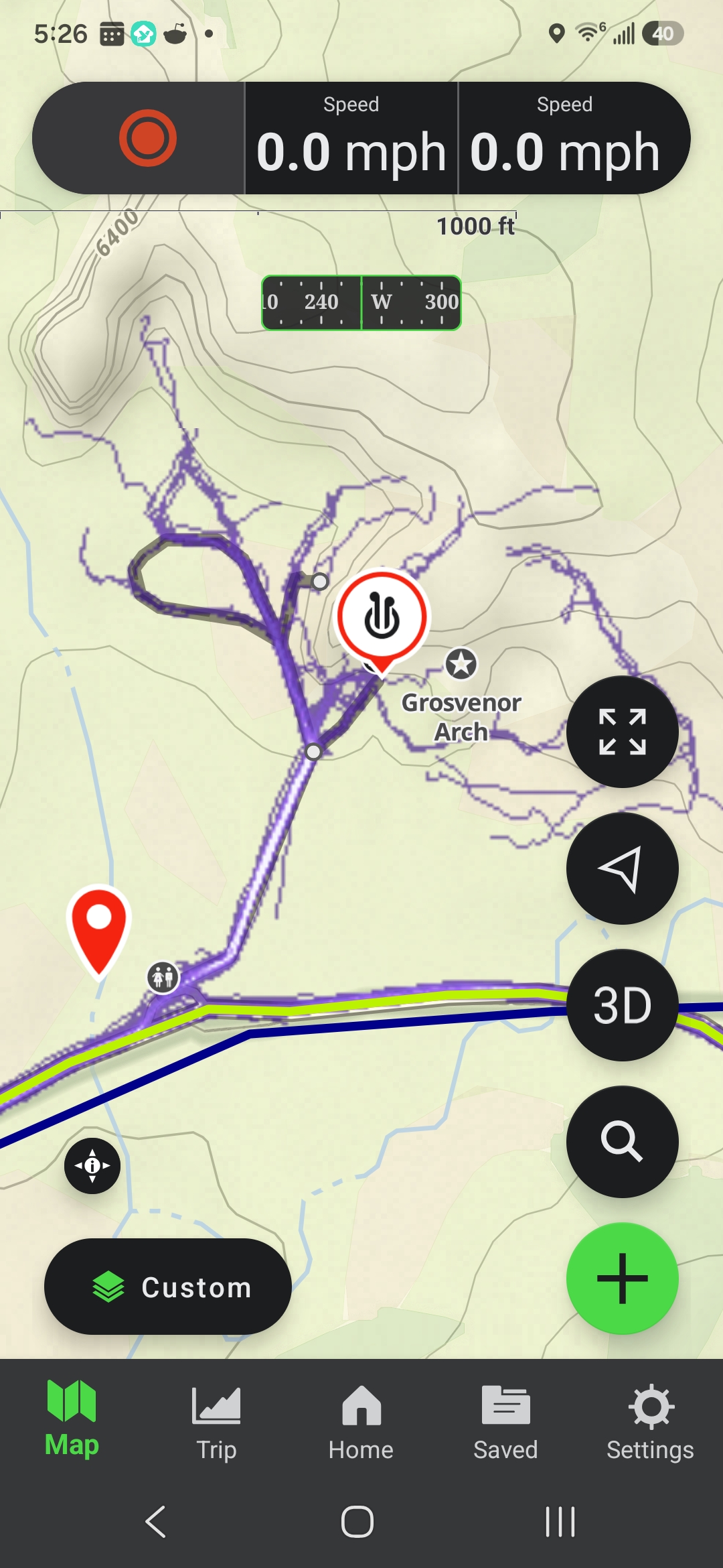
The Strava heatmap is crowd-sourced route viability data, overlaid on your topo map. Anywhere people have walked, run, biked, or skied and recorded it on Strava (Garmin watches!) will show up as a heat signature. In areas with good Strava coverage (lots of recreation), you can see which gully through a cliff band has been traveled, which col has foot traffic, and which roads get enough use to make hitching viable.
For off-trail route-finding this is genuinely useful: even a single connected heatmap trace through an otherwise blank cliff face means someone went that way, which means the terrain probably goes. It’s not perfect, because many legitimate lines have never been recorded, or have not been recorded recently, but in popular ranges the coverage is dense enough to matter. I use it as a standard layer for any trip with cross-country travel and off-trail navigation.
The obstacle is that Gaia GPS can’t load the Strava heatmap natively. The tile URL requires Strava authentication that Gaia can’t handle. The fix is a proxy: a small Cloudflare Worker that sits between Gaia and Strava, manages the session, and passes tiles through as a standard tile source. Free to run, about 30 minutes to set up, no coding required.
Step-by-step setup guide: Cloudflare proxy, Gaia custom layer, tile options
The Big Sur Trail Network for Gaia
Big Sur and the Ventana Wilderness have a trail condition problem. The Santa Lucia Mountains take a beating on a rolling cycle: fire sweeps through, then atmospheric rivers hit the burned slopes and bring debris flows and washouts, then another fire season starts the process over. The trail network at any given time is a mix of maintained trails, overgrown social paths, official reroutes, and segments that have simply ceased to exist. Published maps are always behind and questionably useful.
BigSurTrailMap.net, maintained by Jack Glendening, is the best conditions resource for the Big Sur region. This has been a truly tremendous, community-involved project to update trail conditions, and make backcountry travel fun! It’s updated regularly, color-coded by trail passability, with notes on specific problem areas. For years I would just make notes and plan out my trails well in advance. However, taking screen shots and saving them to my phone to remind me of trail conditions if plans changed was never ideal. One too many aggressive bush whacks through unexpected poison oak on hardly-passable trails also left me thinking there might be a better way to take information from BugSurTrailMaps.net with me in Gaia!
The issue for Gaia users is that the data exists as a KMZ file that doesn’t integrate natively with Gaia GPS and its color-coding system.
I wrote a Python script that runs every Sunday on my server. It downloads the latest KMZ from BigSurTrailMap, converts the condition codes to Gaia’s GPX color extension format, and saves the result to a public URL. Import it into Gaia once and the full trail network (around 520 color-coded track segments) appears as a toggleable layer over any base map. When conditions update substantially, delete the old folder and re-import the fresh file. I do this every time I head out to the region.
Color-coded GPX of ~520 trail segments, updated every Sunday from BigSurTrailMap.net